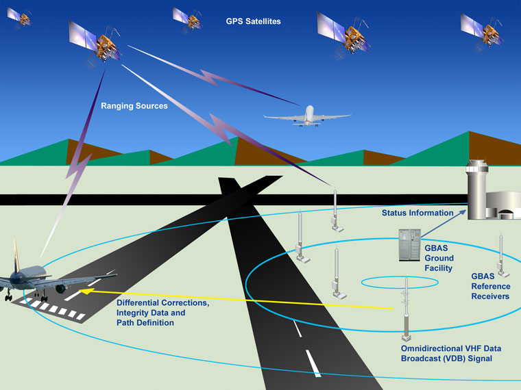
The Federal Aviation Administration has issued flight advisories for GPS interference testing at Camp Shelby, Mississippi, from 13 to 20 August and at San Clemente Island, California, from 12 to 15 August. The tests may render GPS, WAAS, GBAS and related services unreliable or unavailable across defined radii and altitude bands. NOTAMs will be published in advance. Pilots are advised to check them frequently and to report anomalies.
These are scheduled military exercises. They are also a recurring reminder that the navigation backbone of modern aviation is not always available. GNSS accesses en-route navigation, approach procedures, ADS-B surveillance, terrain awareness and the moving maps that many general-aviation, business-aviation and helicopter crews now treat as primary. When the signal is degraded or lost, crews must fall back on traditional radio aids, inertial systems, visual navigation and procedural techniques that receive less day-to-day practice in an era of GNSS dependence.
General-aviation pilots, business-jet operators, helicopter crews and drone operators experience the loss differently. A light aircraft on a VFR cross-country may simply lose its moving map and have to navigate by pilotage and dead reckoning. An IFR flight relying on a GPS approach may have to divert or execute a different procedure. Helicopters operating in remote or offshore environments can lose precision guidance at low altitude. Airport approaches that depend on satellite-based augmentation become unavailable within the affected volume. Drones that lack robust non-GNSS navigation may be forced to land or return home under contingency programming.
The domestic tests are controlled and announced. The global environment is less orderly. Intentional jamming and spoofing have become routine in and around conflict zones, including the Eastern Mediterranean, the Black Sea, the Baltic region, the India-Pakistan border area and parts of the Middle East and East Asia. Spoofing can produce false positions that appear valid to the receiver. Jamming simply denies the signal. In both cases the pilot’s instruments may disagree with reality, and the workload rises sharply.
Proficiency in non-GNSS navigation is therefore no longer a nostalgic skill. It is a practical requirement. Operators need current procedures for loss of GNSS, regular practice of VOR, DME, NDB and visual navigation where available, and clear decision criteria for when to divert rather than continue. Aircraft systems that cross-check multiple sensors and that alert clearly when GNSS integrity is lost reduce the risk of silent degradation. Training that treats GNSS outage as a normal contingency rather than an exceptional emergency prepares crews for the moments when the satellite constellation is no longer trustworthy.
The August tests at Camp Shelby and San Clemente Island will last only days. The underlying vulnerability will outlast them. Civilian aviation has built much of its modern efficiency on a navigation system that can be deliberately denied. The question the tests quietly pose is whether the industry’s procedures, training and equipment are ready for the periods when that system is no longer there.